Use these map directions and notes to plan your trip to Coyote Cal’s. By connecting and reversing these Baja off-road trails, you can plan your routes from Ensenada, Tecate, Mike’s Sky Ranch, Rancho El Coyote, and the Old Mill in San QuintÍn. (The AAA map, as shown in the map page, is accurate and shows most of the major intersections. Read it carefully and you should be able to follow any of these routes.) Go to map
 Park your vehicles on the US side of Tecate. There is a vehicle storage area with great security and is fairly inexpernsive. Your bikes can ride to the front of the boarder wait upon your return. FastLane passes are available at Coyote Cal's for chase trucks returning home via TJ/San Diego. Fuel range is about 65 miles.
[Santa Veronica to Ojos Negros] The easiest way to start is to leave east out of Tecate on the free road. Go ten(10) miles past the small town of loma Tova which has a Pemex and regular gasoline. About two miles past Loma Tova you make a right turn toward Rancho Santa Veronica, this is a dirt road that is well marked and well traveled. This road marks the beginning of the Compadre Road or more commonly known as the Compadre Trail.
The Compadre Trail passes the well known area of Santa Veronica which has a lot of trail opportunity. This trail is about 55 miles, and this two track trail is in good condition all the way to Ojos Negros. It passes Compadre Ranch, the trails namesake. Fuel is available at the ranch but don't count on it. The trail is well marked, there are a few turns off the southerly trail as your are riding to Ojos Negros, but nothing that would inadvertently take your off main trail. The Compadre Trail is easy to follow, and well Marked on the AAA map. As you near Ojas Negros, the road makes a decisive turn to the west and brings you straight into Ojos Negros.
Gates: Although there are no gates to date on the trail, the local Ejidos and ranchers have used internet information to ambush larger tour groups to check if they have permits or to ask for money. If you get caught by this action, you will need to back track and use the La Rumorosa crossover trail, then head south to Trinidad.
 [La Rumorosa to Ojos Negros] Instead of starting south at the San Veronica, EI Hongo area, continue farther east to La Rumorosa. This is clearly marked on the AAA map. From La Rumorosa you need to pick up the dirt road south that will take you towards the Parque Ntional, also known as Laguna Hason and the pine forest.
This track is not obvious, it tricky to pick-up. But there are markers along the way to tell you are headed south to the national park. Ultimately this trail will take you past Laguna Hason, don't expect to see any water there, but it has a very beautiful view. About four miles south of Laguna Hason, there is a very popular stopping spot known as Ramonus, or more commonly known as The Saw Mill.
It is a small housing area with gas. Food is also available. From Ramonus contiune on the same route that will start turn west taking you to Ojos Negros. There are at least two different turns where you can turn to the south to hit Hyw-3 before coming to Ojos Negros or you can continue on the primary dirt road, and it will take you into Ojos. Once in Ojos Negros you can pick of the southerly route a described above. This route is about 60 miles between gas stops.
Gates: While on the Compadre trail there is a crossover road about 5 miles from the border. Taking the lower road, it will come out at El Topo and put you on the Santa Veronica trail. There is one ranch gate in the middle of the crossover trail. This may have a small charge to cross. Near the end of the Santa Veronica trail there is one ranch gate and at the end of the trail there is an old locked gate. It is possible for even trucks to drive around them.
[Ojas Negros to Coyote Cal's]The most important off-road trail that connects Oso Negros to Hwy 1 is now closed to all off-road traffic. In the past, the large metal gate on the south side of Hwy 3, could be crossed by paying a $5 to $20 free to the ranch house to the left of the gate. However, the two new gates at Tres Hermanos are now locked, preventing all traffic going both south and north on this important trail. The attorney Hector Sarabia ( sarabia/en@hotmail.com) has organize the destruction for free trail access in Baja in order to promote his project of a private off-road park. He is the single most influential person who has a lot of responsibly for the closing of access to open trails. I suggest everyone "boycott" all projects he is involved in. This man is not a friend of the off-road community!
The alternative route is not great. Basically, the alternative route is by riding hard top. Hwy 3 from Oso Negros to Valley de Trinidad. There you can take the Cross-over trail to Hwy 1. Then take the "San Maria" trail just south of San Vencente. That trail takes you to the Costal route to Coyote Cals, or San Quintin. That’s a lot of hard top and a lot of extra time. But both trail bike and sport bikes can do this. For the expert riders you can take a side rout, "The goat trail" for some extra off-road riding.
You can also go west on Hwy 3 to Ensenada and then connect to Hwy 1. Then go south to the Coastal route. You can start the Coastal trail at Santo Tomas.
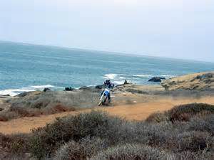
From the Pemex in Santo Tomas, you will continue on the pavement south, about half a mile, and make the first obvious right hand turn into the dirt through the little town area. The road climbs sharply up the hill. This road continues out to the coast. Beware of oncoming traffic. This route is suitable for most vehicles, some rocks and sand. Check current updates! You will go about fourteen(14) miles and come to a major left hand turn. Take that turn. If you go straight and not take the turn, it will take you to the lighthouse at Punta San Jose. It's a nice ride out there but road dead ends and you will have to return to the intersection and go south to follow the coast. You will wind through the hills. In a few miles you will see the ocean. This trail becomes the Southerly Coast Route. Just follow the coast and it will take you to Coyote Cal's, located on the left hand side of the road at the north end of the town of Erendira. Fule, Motorcycle repair parts, Bar, Food, Massage and safe lodging available at Coyote Cal's.
You may want to avoid all this unwelcoming behavior and gates by following a new trend to trail head at Coyote Cals. We will watch your vehicles for free so you can start your ride going further south to San Quintin and maybe Catavina, good for a weekend ride. Stay at Coyote Cals and the beginning or end of your ride!
From the Pemex in Santo Tomas, you will continue on the pavement south, about half a mile, and make the first obvious right hand turn into the dirt through the little town area. The road climbs sharply up the hill. This road continues out to the coast. Beware of oncoming traffic. This route is suitable for most vehicles, some rocks and sand. You will go about fourteen(14) miles and come to a major left hand turn. Take that turn. If you go straight and not take the turn, it will take you to the lighthouse at Punta San Jose. It's a nice ride out there but road dead ends and you will have to return to the intersection and go south to follow the coast. You will wind through the hills. In a few miles you will see the ocean. This trail becomes the Southerly Coast Route. Just follow the coast and it will take you to Coyote Cal's, located on the left hand side of the road at the north end of the town of Erendira. Fule, Motorcycle repair parts, Bar, Food, Massage and safe lodging available at Coyote Cal's.
It is also possible to enter the El Alamo trail north of Independencia just south of the San Francisco gated entrance. Follow the fence until it brakes and allows you to back-track along the fence to the El Alamo trail. Then take the El Alamo to Tres Hermanos. Then continue the trail to Uruapan and down the coast to Cal’s.
 This is a full day ride for most groups and a little more technical than the Tecate trails.
[Ensenada to EI Alamo] This trail is now gated. The alternative route is not great. Basically, the alternative route is by riding hard top. Hwy 3 from Oso Negros to Valley de Trinidad. There you can take the Cross-over trail to Hwy 1. You can take the “Goat trail for some expert fun.
[Independencia to Mike's Sky Ranch and El Coyote] One you hit Hwy-3 you will be north of the area of Independencia. Turn south on Hwy-3 and continue about twenty(20) miles to Valle de la Trinidad. Gas is available here. From Valle de la Trinidad you will be heading toward Mike's Sky Ranch. You will take a major dirt road, along the power line heading south out of town. This is a well marked turn. this trail runs about ten(10) miles through the mountains. The trail is a very gentle route. At a point you will come to a road junction where you will make a left hand turn. The trail continues for another ten(10) miles and dead-end at Mike's Sky Ranch Road. When the road dead-ends, you will turn to the right and proceed south about another eight(8) miles into Mike's Sky Ranch. This road passes through a mountain area. The road is in good condition.
 [Mike's Sky Ranch to Coyote Cal's] To continue to the west coast you will pass the front of Mike's and start the climb to the back side of the Ranch. The trail becomes significantly more difficult.
This area is intermediate to advance level for motorcycles for about the next twelve(12) miles. It goes over the mountains toward the area known as El Coyote, a small ranch area where something gas is available. It is important when you reach El coyote you take a major left hand turn, over a cattle guard, that will take you around to the well marked front entrance to El Coyote.
El Coyote has gas and soda for sale plus the owners are happy to give direction if neede. After El Coyote, you will continue south on what is now a major graded road for about five(5) miles. This takes you to the San Telmo Road, also called the observatory road near Meling Ranch. The San Telmo road is paved and runs to the west. Take this road about thirty-five(35) to Hwy-1. You will come out at the town of San Telmo. From here, you turn noth on Hwy-1 about seven(7) miles to the town of Colonet.
If you want to have more dirt to ride on after you leave El Coyotes, you can take the “Cuesta Blanca” trail just south/west of El Coyotes and ends at El Carricito intersection, if you don’t want to take less black-top on the observatory road. You will have to first contact a very nice man “Alfredo Orhart” 616-123-9739, and ask permission for him to open his ranch gate. This gate is always locked so call him before you take your trip! About one mile before the gate there is a trail to the south. Take that trial. Pass the first opportunity to turn right, that road goes back to the ranch house, in about one mile you will see the corner of a fence that may be down, it can also be unhooked by hand, cross it and continue until you find the old trail again. The detour is about two and a half miles.
[Colonet to Coyote Cal's] Go through the town of Colonet and cross over the major wash/bridge. Take an immediate left. That will take you to San Antonio Del Mar. It's a good graded road that will take you to the coast. From there you can start north following the coastal route up to Coyote Cal's, just north of Erendira. Parts of the coastal trail are rough because they are part of the Score 500, 1000 race course. This route is suiltable for off road capable vehicles, rocks, sand and some rough road and whoops. Initially this route can be difficult to follow because of the many agricultural roads that intersect. Just keep heading north. As you approach Erendira you will pass coastal homes and farm fields. Cross the sand wash and turn left at the south end of Erendira on a paved road. Coyote Cal's is north about three miles and is located at the end of the power poles. Look for palm trees and a large white building. Fuel, Motorcycle repair parts, Bar, Food, Massage and safe lodging available at Coyote Cal's
Gates: You will come across two gate in this area. Near the point the area farm has built a fence to the cliffs. There is enough room between the fence and the cliff to pass. The second gate near punta Camalu can be ridden around.
[Valle de la Trinidad to Coyote Cal's] In place of the Power Line Trail to Mike's you can take a faster trail called the Cross-Over Trail or also known as the Calantura Trail. About three miles south of Valle de la Trinidad at the substation you make a right hand turn to follow the major Calantura Trail. Most of it is graded and it goes over one mountain pass.
There are short parts of it that are rocky and narrow. But in general is a good and easy trail to ride that takes you about thirty-five(35) miles to hit Hwy-1 at Calantura. From calantura turn noth on Hwy-1 toward San Vicente go about four(4) miles. Make a left hand turn on a major graded road just half mile past the Rancho Santa Marta School. This road goes about three(3) miles makes a left hand turn then a quick right hand turn to continue out to the coast. This trail is called the Cerro Solo Trail. It is about ten(10) miles to the coast from the two turns. Once you reach the coast turn north to Coyote Cal's located north of Erendira. Fuel, Motorcycle repair parts, Bar, Food, Massage and safe lodging is available at Coyote Cal's
 Basically the coastal trail from San Quintin to Coyote Cal’s is achieved by following the most well traveled coastal road. It is a challenging ride because the trail changes a little in the area around the Punta Colonet/Cobo Colonet. In addition, there are many alternate routes because many people in the area use the coast and make many alternate ways of getting there. This allows you to change up your trip and maybe use the coastal route going down and the mountain crest route coming up.
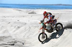
Starting at San Quintin hotels like the Old Mill, Santa Maria, or Jardines, you travel north to Lazaro Cardenas. In areas like Lazaro Cardenas it is possible to ride on the beach. There is a section that goes between Lazaro Cardenas and the Rio Santo Domingo river mouth/Vicente Guerrero area where you can ride about seventeen (17) miles of beach. Another beach run is available about five (5) south of Erendira. It is best to plan your ride during low tides in these areas.
A Punta Camalu you have a choice of following the coastal route to Ship Wrecks, Freighters, Robert’s Lefts, Quatro Casas and then to Punta San Telmo. At Cabo Colonet you can continue the coastal route or follow the river bed to Colonet for gas and food.
At Punta Camalu you can ride the mountain crest trails that at first travel north-east and parallel Hwy-1, then turns back west and connects to the coastal trails near San Antonio Del Mar. You can also follow a mountain trail starting north of Colonet running north-west and south of Rincon de Guadalupe and ends at the coast near Cerro Solo. Once at Colonet follow the direction from Colonet to Coyote Cal’s. Fuel, Motorcycle repair parts, Bar, Food, Massage and safe lodging is available at Coyote Cal’s.
Gates: A gate near Los Molinos can only be passed by going along the beach at low tide or driving east to Hwy 1 and then driving back to the coastal trail. North of Campo San Ramon if you plan to ride the trail and not the beach, there is an electrified wire across the trail. Very dangerous! You can disconnect and pass.
Go to Colonet to Coyote Cal's